
Open 7 days a week at 22 William Street in historic downtown New Bedford
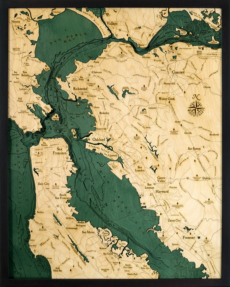


A 3-D nautical wood map featuring the San Francisco Bay Area. It measures 24.5" x 31". A shallow, productive estuary, San Francisco Bay connects the Sacramento and San Joaquin rivers with the Pacific Ocean. Gathering the rainfall and snowmelt from an enormous watershed, these outflows drain approximately 40% of California into the bay, which then flows out (under the Golden Gate Bridge) into the Pacific Ocean. It's the largest Pacific estuary in the Americas and, despite significant mining- and construction-related damage over the past century, it remains a rich part of the coast. Points of interest include: San Francisco, Oakland, Berkeley, Vallejo, San Rafael, Sausalito, Alameda, Golden Gate Park, Alcatraz, Bay Bridge, Redwood City, and Palo Alto.
Love this product? Login to your customer account and add it to your wishlist!
It all starts with an idea, full of potential, and ready to be transformed. Let's discover what we can create together.
Sign up for our monthly newsletter, The Sketchbook.