Open 7 days a week at 22 William Street in historic downtown New Bedford


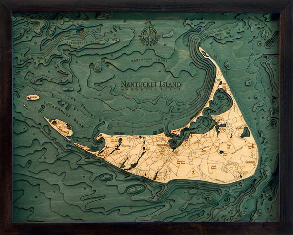
A 3-D nautical wood map of Nantucket Island that measures 20'' wide by 16" high
Nantucket is primarily an affluent summer colony. Most of its homes are seasonally occupied, and in the summer months the island's population swells from 10,000 to over 50,000. It's accessible only by boat or by air. The wharves and cobblestoned streets of the Town of Nantucket are lined with restaurants, high-end boutiques and steepled churches. The town’s Whaling Museum recounts the island’s role as a 19th-century whaling hub.
Points of Interest Include:
Brant Point Light, Coskata-Coatue Wildlife Refuge, Great Point Light, Muskeget Island, Nantucket State Forest, Sankaty Head, and Tuckernuck Island.
The laser cut map is made from Baltic birch and has a solid wood frame behind plexi-glass. The maps arrive ready to hang.
Love this product? Login to your customer account and add it to your wishlist!
It all starts with an idea, full of potential, and ready to be transformed. Let's discover what we can create together.
Sign up for our monthly newsletter, The Sketchbook.
